Downloading
The download interface is implemented following the Web Coverage Service (WCS) as well as the Download Service for Earth Observation Products Best Practice (DSEO) standards.
These interfaces support both, the simple download of entire products via DSEO
as well as flexible customized downloads via WCS. Both services can be accessed
at the path /ows?.
The WCS offers the following customizations in order to optimize downloads and minimize unnecessarily used bandwidth:
Meaningful default configuration
Spatial subset to retrieve only the geographic area of interest
Range subset to retrieve only the band(s) of interest
Scaling to required resolution
Format selection
Interpolation selection if needed
Projection selection
Note that the download size in WCS is restricted in order to not block the service. Clients are advised to download bigger coverages in chunks and put them together afterwards.
Downloading in QGIS
In order to use the download via WCS 1.0, that QGIS supports, a WCS layer needs to be added.
Open the Data Source Manager and add a WCS Layer, configuring the URL as shown in Figure 50 and create a new WCS Connection using the URL of the service and specifying the product id to be downloaded via CQL= query. It is necessary to tick the Ignore GetCoverage URI reported in capabilities, as the reference URI usually does not contain the additional CQL or any other request parameters.
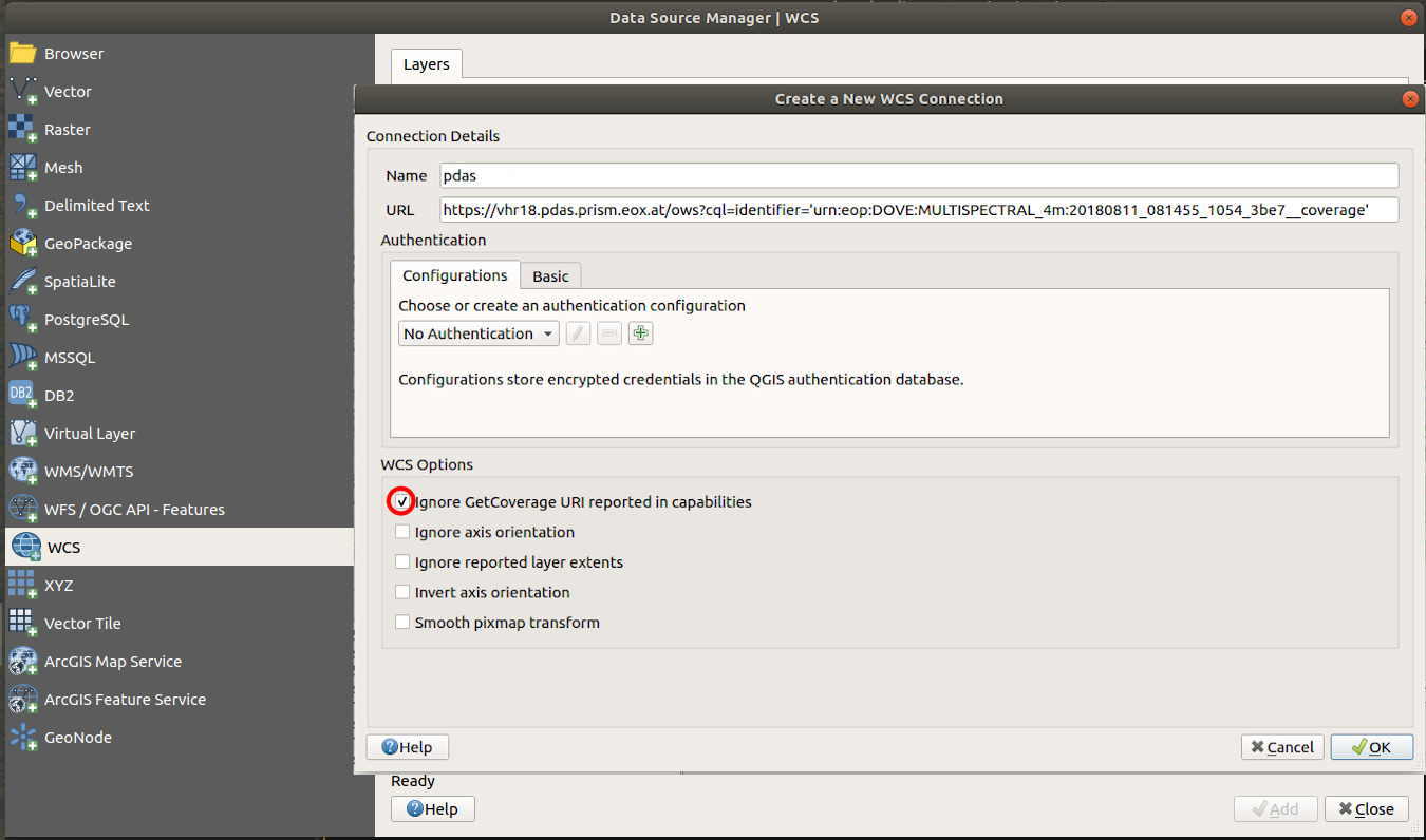
Figure 50 QGIS - Create WCS Connection
A user can be prompted to specify the transformation between coordinate reference systems in case that the default output image is in a different coordinate reference system than current map projection - as shown in Figure 51
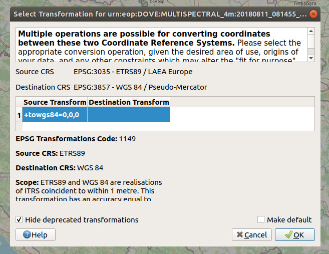
Figure 51 QGIS - CRS transformation confirmation
Currently, QGIS supports specifying the output coordinate reference system and image format through the relevant input fields as shown in Figure 52. All other optional parameters for WCS request need to be added to the URL manually clicking on Edit button.
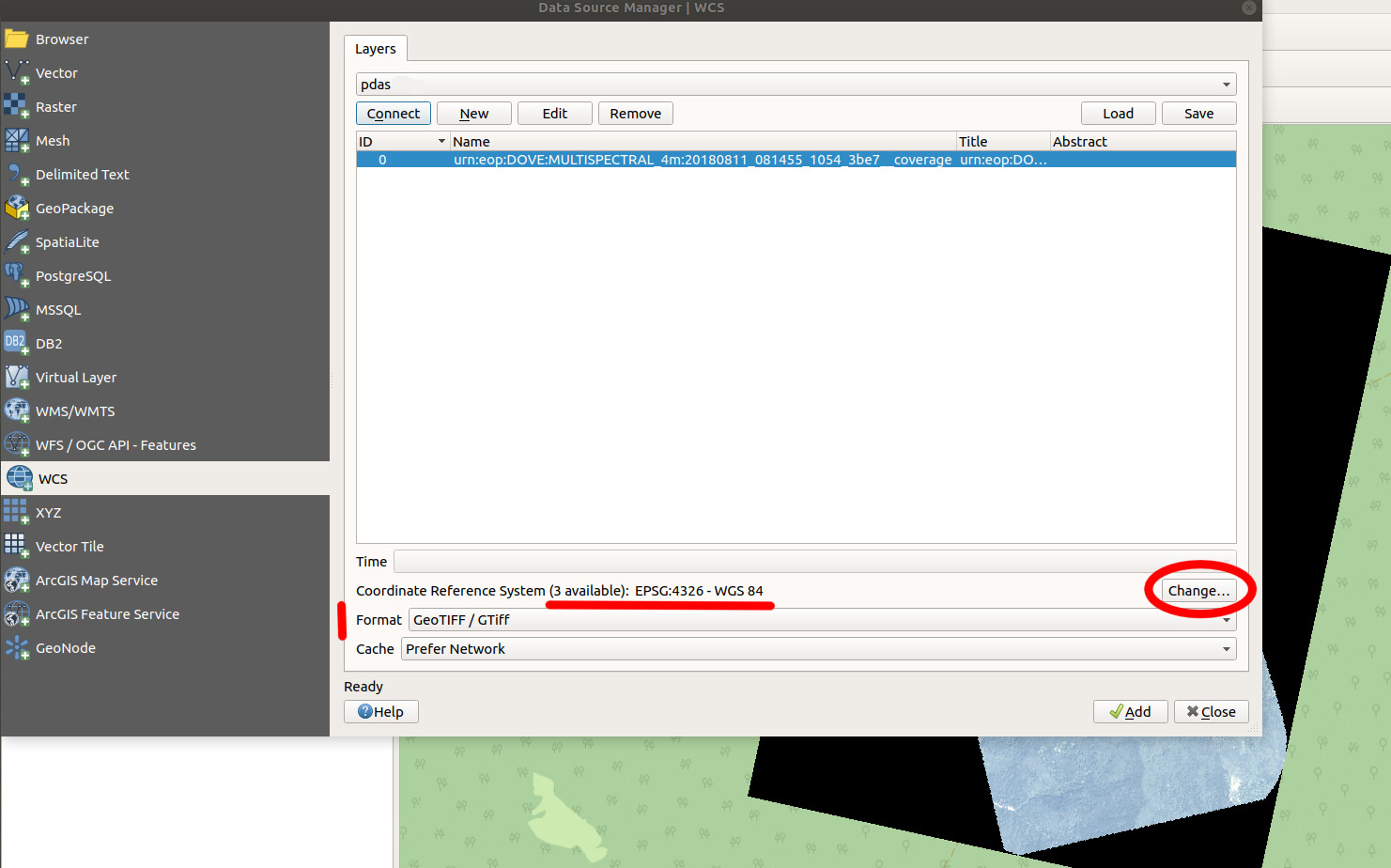
Figure 52 QGIS WCS layer options
The final chapter sample_requests holds a list of sample requests against the various services described in this user guide.